


Brewer High School, Morgan County, Alabama
About
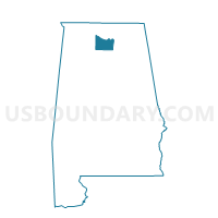
Outline

Summary
| Unique Area Identifier | 522726 |
| Name | Brewer High School |
| County | Morgan County |
| State | Alabama |
| Area (square miles) | 21.74 |
| Land Area (square miles) | 21.68 |
| Water Area (square miles) | 0.06 |
| % of Land Area | 99.70 |
| % of Water Area | 0.30 |
| Latitude of the Internal Point | 34.41716440 |
| Longtitude of the Internal Point | -86.69539260 |
Maps


Graphs
Select a template below for downloading or customizing gragh for Brewer High School, Morgan County, Alabama


Neighbors
Neighoring Voting District (by Name) Neighboring Voting District on the Map
- Cotaco School, Morgan County, AL
- Oden Ridge Volunteer Fire Dept, Morgan County, AL
- Ryan School, Morgan County, AL
- SAVES Fire Dept #1, Morgan County, AL
- Union Hill Jr High School, Morgan County, AL
Top 10 Neighboring County Subdivision (by Population) Neighboring County Subdivision on the Map
- Somerville CCD, Morgan County, AL (10,369)
- Laceys Spring CCD, Morgan County, AL (9,034)
- Eva CCD, Morgan County, AL (5,655)
Top 10 Neighboring Place (by Population) Neighboring Place on the Map
Top 10 Neighboring Unified School District (by Population) Neighboring Unified School District on the Map
Top 10 Neighboring State Legislative District Lower Chamber (by Population) Neighboring State Legislative District Lower Chamber on the Map
Top 10 Neighboring State Legislative District Upper Chamber (by Population) Neighboring State Legislative District Upper Chamber on the Map
Top 10 Neighboring 111th Congressional District (by Population) Neighboring 111th Congressional District on the Map
Top 10 Neighboring Census Tract (by Population) Neighboring Census Tract on the Map
- Census Tract 57.02, Morgan County, AL (6,376)
- Census Tract 56, Morgan County, AL (5,655)
- Census Tract 54.05, Morgan County, AL (5,208)
- Census Tract 57.01, Morgan County, AL (2,658)